Interventions on Delivery areas
Delivery Areas: The Complete Guide to Understanding, Equipping, Managing, and Modernizing Urban Logistics Spaces in Municipalities
 The delivery areas represent in France a strategic urban network, estimated at more than 30,000 identified locations in 2024 according to the cross-referenced data from urban logistics observatories. With the explosion of e-commerce (more than 4 billion packages delivered annually in France according to Fevad) and the increasing number of last-mile deliveries, these reserved spaces are becoming a central issue for urban mobility. This guide details everything a manager, an elected official, a road service or a maintenance provider needs to know about delivery areas, their rules, their stakeholders and their daily maintenance.
Presentation of delivery areas: an essential link in urban logistics
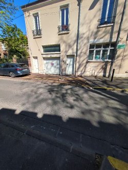
 In technical and regulatory terms, a delivery area refers to a parking space located on the public road, reserved exclusively for loading and unloading operations. It is also referred to as a delivery reserved space, a yellow spot (in reference to the marking), a professional minute stop, or an urban logistics area. These facilities are marked by a B6d sign (no parking except for delivery vehicles) or a yellow ground marking with the word "DELIVERY" written on it.
These locations can be found in a wide variety of contexts. Commercial city centers, pedestrian zones with regulated access, market surroundings, arcades, restaurants, hotels, tertiary areas, and dense residential neighborhoods. The diversity is such that the design, sizing, and management vary significantly from one site to another. Indeed, behind the generic term "delivery area," one can find both a simple marked location on the ground and a real urban logistics hub equipped with electric charging stations and connected sensors.
What exactly is a delivery area?
The regulatory definition mainly comes from the Road Code and the interministerial instruction on road signage (IISR). A delivery area is "a specific parking space reserved exclusively for loading and unloading operations, excluding any other use". The usage duration is generally limited to 30 minutes (sometimes 20 or 15 minutes depending on municipal decrees), with mandatory use of a professional parking disc.
From a typological point of view, several major families can be distinguished. The classic delivery areas, simple marked locations at the edge of the road. The sanctuary delivery areas, protected by retractable bollards or posts to prevent abusive parking. The shared areas, which change their use depending on the time of day (delivery in the morning, paid parking in the afternoon). The urban logistics spaces (ULS), real platforms for sharing the last kilometers. And the connected areas, equipped with sensors for automatic occupancy detection.
Why are delivery areas strategic for a community?
A delivery area is not just a minor detail of road infrastructure. On the ground, feedback from elected officials shows that urban logistics is now among the central issues in mobility policy, right after public transport and residential parking. A municipality that does not properly size its network of delivery areas immediately sees the consequences: double lanes, deliveries on sidewalks or pedestrian crossings, traffic jams, usage conflicts, and degradation of the commercial image of the city center.
The economic stakes are massive. According to several studies by Cerema and Ademe, freight traffic accounts for 25 to 30% of traffic in densely urban areas, and up to 40% of air pollution related to transportation. Last-mile logistics cost an average of 20% of the total delivery cost, and this ratio increases dramatically when delivery areas are insufficient or poorly located. A well-managed delivery area smooths traffic flows, reduces the average time spent by drivers (estimated at 15-30 minutes per stop), and limits nuisances for nearby residents.
What are the main types of delivery areas?
Urban planners distinguish several categories of facilities. The permanent areas, dedicated 24/7 to deliveries, ideal in highly active commercial or tertiary zones. The time-limited areas, reserved exclusively in the morning (typically 7am-11am or 6am-12pm) and released for public parking the rest of the time. The multi-purpose shared areas, which combine delivery, taxi drop-off, and other short-term uses.
In addition, there are electrified areas with charging stations for electric utility vehicles, which are becoming more widespread as fleets evolve. The protected delivery areas equipped with retractable posts or poles, managed via license plate or professional badge reading. The urban logistics spaces (ELU), real mini-platforms where carriers drop off packages for final deliveries by cargo bikes or light vehicles. This diversity reflects the rapid evolution of the urban logistics sector over the past ten years.
How many delivery areas are there in France?
There is no comprehensive national census, which in itself is revealing. However, several estimates converge. Paris has about 9,500 delivery areas within its territory (2023 figure from the City of Paris). Lyon manages more than 1,200, Marseille about 800, and Bordeaux and Toulouse each around 600. On a national scale, it is estimated that between 30,000 and 40,000 delivery areas are distributed across cities with more than 10,000 inhabitants.
For comparison, there are approximately 35,000 communes in Metropolitan France, but delivery areas are concentrated mainly in medium and large cities. The majority of rural and peri-urban communes have no formal delivery areas, with deliveries taking place directly in front of shops or houses. This geographic inequality raises questions in light of the growing influence of e-commerce, which now reaches the entire territory, including the least densely populated areas.
What is the lifespan of a delivery area?
The lifespan of a delivery area mainly depends on the quality of the ground marking and vertical signage. Preformed thermoplastic marking lasts 3 to 5 years under average traffic conditions, up to 7 years for the best products. Traditional road paint marking lasts rather 1 to 2 years and requires annual repainting. For signage panels, the lifespan is 7 to 10 years (degradation of retroreflective films).
For complementary equipment (retractable posts, sensors, charging posts), the lifespan varies from 5 to 15 years depending on the technology and usage intensity. Experience reports from road services show that in more than 70% of cases, it is not the equipment itself that fails first, but the ground markings worn away by vehicle traffic. A regular repainting program (every 1 to 2 years depending on traffic) significantly extends the readability of the system.
What materials for durable delivery areas?
The choice of materials affects the lifespan and readability. For floor marking, hot thermoplastic is now preferred for highly trafficked areas: durability, slip resistance, retroreflection. Cold-setting MMA (methacrylate) resins offer an excellent finish and long lifespan in pedestrian areas. Conventional road paint is still used for quick and economical refreshments.
For vertical panels, mainly class 2 retroreflective film coated aluminum (day/night dual use) is used. For recessed posts, stainless steel or thermally painted galvanized steel predominate, sometimes aluminum castings for heritage areas. Protection stanchions can be made of steel, cast iron, polymer, or even reconstructed wood depending on the architectural environment. Aesthetic choice is as important as technical performance.
What are the current trends regarding delivery areas?
The sector has been evolving very rapidly since 2018 under several influences. First, digitization: occupancy detection sensors (radar, camera, magnetometer), advance booking applications for transporters (such as FlowOps, Telaqua, Cocolis), real-time dashboards for road services. Several metropolitan areas (Paris, Lyon, Strasbourg, Toulouse) are testing large-scale connected devices.
Next, automatic verbalization: cameras with license plate recognition (LAPI), reinforced public road surveillance agents (ASVP), algorithmic control of abusive parking. On the ground, these measures have increased the effective occupancy rate of delivery areas by authorized vehicles from 30-40% to over 80% in the most monitored areas. A real operational revolution.
Third trend, decarbonized logistics: multiplication of urban logistics spaces, integration of cargo bikes, charging stations for electric utility vehicles, increasing ZFE (low-emission zones) constraints that require rethinking the network. Finally, shared resources: shared areas between carriers, grouped deliveries, and even silent nighttime delivery experiments in several pioneering cities.
Regulations and standards for delivery areas: a dense and evolving framework
French regulation regarding delivery areas is based on a stack of texts: Road Code, General Code of Territorial Collectivities, instructions on road signage, municipal decrees. Understanding this framework is essential, both for the project owner and for transporters and controllers.
What are the texts that govern delivery areas in France?
Several texts structure the framework. The Code de la route, in its articles R. 417-10 and following, defines abusive and obstructive parking. Article R. 417-10 specifically states that parking for more than 7 days in the same location is considered abusive, but more restrictive rules apply to delivery areas through municipal decrees. The article R. 417-11 classifies certain parkings as "very obstructive" (4th class, fine of 135 €).
In addition, the Interministerial Instruction on Road Signage (IISR), particularly its volumes I (generalities), IV (prescriptive signage), and VII (road markings), detail the technical characteristics of signs and specific markings for delivery areas. The General Code of Territorial Collectivities (article L. 2213-2) grants the mayor the police power to regulate parking, including the creation and control of delivery areas. Finally, municipal decrees specify locally the hours, durations, and conditions of use.
How to legally report a delivery area?
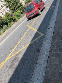
The signage of a delivery area is based on a standardized device. The B6d sign (no parking) accompanied by a M6c plaque "DELIVERIES" officially defines the area. On some areas, you may also find the C1c sign (parking area) with specific mention. The ground marking is yellow with the word "DELIVERY" in letters of at least 50 cm in height, in accordance with the NF P98-405 standard on road markings.
The length of a delivery area is generally between 8 and 15 meters to accommodate a truck or several utility vehicles. The width must allow for handling (at least 2.30 meters, ideally 2.50 meters for high-traffic areas). The IISR also specifies the installation conditions: visibility, distance from intersections, compatibility with pedestrian crossings.
What is the maximum duration of occupation for a delivery area?
The maximum occupation duration is set by the municipal decree. The prevailing rule is 30 minutes, sometimes 20 or even 15 minutes in highly congested areas. To apply this rule, the driver must use a professional parking disc or an equivalent device (connected badge, mobile application). The enforcement is either visual by public road agents or automatically via new sensors and cameras.
Failure to comply with the duration constitutes a nuisance parking, subject to a fixed fine of 35 € (2nd class), increased to 135 € (4th class) for parking considered as highly nuisance (on sidewalk, pedestrian crossing, cycle lane). Several cities have also introduced specific post-parking fees, notably since the depenalization of paid parking in 2018.
Who can use a delivery area?
The beneficiaries of the delivery zones are strictly defined by municipal decrees. Generally authorized are: freight vehicles during loading or unloading operations, merchants and artisans restocking their premises, and delivery professionals (e-commerce, grocery delivery, catering, pharmacy). Personal vehicles, even for short durations, are not authorized.
Several cities have specified the rules with tolerances. For example, Paris allows moving vehicles under certain conditions, taxis and ride-hailing vehicles in service for very short stops, or certain emergency or technical vehicles during interventions. On the contrary, some areas are reserved for clean vehicles (Crit'Air 1 or 2 depending on the ZFE), which further complicates enforcement. Feedback shows that the clarity of these rules is often still improving for delivery drivers themselves.
What are the manager's responsibilities?
The road manager has several cumulative obligations. First, the obligation of signaling: to keep the vertical signage and ground markings in good visibility condition at all times. Then, the obligation of maintenance: to clean the delivery areas, clear obstacles, and repair equipment (posts, poles, sensors).
The obligation of control is central: without regular checks, the areas are systematically occupied by private vehicles, making the system ineffective. Finally, the obligation of maintaining a documentary heritage: layout plan of the areas, technical sheets of the equipment, history of interventions. This heritage, often referred to as "SIG road" or "logistical heritage database", is essential to manage the urban logistics policy over time.
How often should a delivery area be maintained?
The maintenance frequency depends on the implementation context. Here are the practices observed in French communities:
| Type of intervention | Subject | Usual frequency |
|---|---|---|
| Visual Surveillance | Check marking, signs, cleanliness, occupancy | Weekly to monthly |
| Surface Cleaning | Scrubbing, removal of wild deposits | Daily to weekly according to zone |
| Re-marking | Repaint the yellow marking and reapply the "LIVRAISON" inscription | Every 1 to 3 years according to wear |
| Replacement of panels | Replace damaged or stolen panels | By the water, according to findings |
| Maintenance of Connected Equipment | Sensors, recessed terminals, charging terminals | Quarterly to semi-annual |
| Usage Control | Verbalization of abusive parking | Daily in dense area |
The frequency must adapt to the reality of each site. A commercial area in a hyper-central location requires daily, or even multiple daily, monitoring and cleaning. An area in a less frequented tertiary zone may be satisfied with a weekly visit. On site, the effectiveness of an area depends essentially on the regularity of the inspection: without enforcement, the system is quickly circumvented by less scrupulous drivers.
What should a delivery area file contain?
The heritage file is essential for sustainable management. It must include, for each area:
- The identification sheet (area number, address, geolocation, dimensions, capacity).
- The municipal decree of creation and any subsequent amendments.
- The layout plan and the marking plan (signage, marking, related equipment).
- Technical sheets for complementary equipment (sensors, terminals, poles).
- The intervention history (re-marking, signboard change, equipment repair).
- Usage statistics (occupancy rate, frequency of citations, citizen complaints).
- Purchase orders and invoices from the service providers involved.
- Potential audit and diagnostic reports.
On site, this file remains too often fragmented between the road service, the municipal police, the mobility service, and the ASVP service. However, in the case of a citizen complaint (a merchant complaining that no one is monitoring the area in front of his shop) or an administrative dispute, the lack of traceability prevents any reasoned defense. It is precisely this point that is pushing more and more local authorities to move towards a centralized digital management.
What does the law say about LEZs and delivery areas?
The Low Emission Mobility Zones (LEMZ), established by the 2019 Mobility Orientation Act (LOM) and strengthened by the 2021 Climate and Resilience Act, have direct consequences on delivery areas. Within LEMZ, only vehicles meeting certain Crit'Air criteria are allowed to circulate, which pushes carriers to renew their fleets with cleaner vehicles (electric, hydrogen, GNV).
Several major cities now include dedicated delivery areas for zero-emission vehicles (Crit'Air 1 or exclusively electric vehicles) with integrated charging stations. Enforcing these rules increases the need for connected devices (license plate reading, Crit'Air verification, dynamic pricing). In 2024, more than 25 French metropolitan areas have implemented a Low Emission Zone, and this trend is expected to accelerate in the coming years.
What risks does a manager face in case of failure?
The liability of the manager can be engaged at several levels. On the civil level, in the event of an accident related to a failure in signage (erased marking invisible at night, sign hidden by vegetation), the liability of the community may be pursued according to Article 1242 of the Civil Code regarding the keeping of things. On the administrative level, the lack of normal maintenance of public equipment may be sanctioned in the event of recurring complaints that are not followed up.
Beyond legal risk, the issue is essentially operational and political. A neglected delivery area sends a negative signal to merchants (who can no longer be delivered to), to carriers (who bypass the area), and to residents (who suffer the consequences of wild deliveries). The electoral and economic consequences can be severe for a commune that allows its logistic network to deteriorate.
Key actors and service providers in delivery areas: top 10 of the sector
The French market for delivery areas is driven by several categories of players: traffic sign manufacturers, suppliers of sensors and connected solutions, road marking service providers, parking managers, carriers, and professional federations. Here is an overview of the main stakeholders, along with their specificities.
1. Signature : the French leader in road marking
Signature, based in the Paris region and a subsidiary of the Aximum group (itself a subsidiary of Colas), is the leading French company in road marking and horizontal signage. The group provides products and services for the marking of delivery areas: paints, resins, thermoplastics, preformed markings. Its strength lies in a nationwide network of agencies and unmatched industrial capacity. Signature is the natural partner for major local authorities for multi-year road marking contracts.
2. Aximum: the Colas subsidiary specializing in signaling and safety
Aximum, a specialized subsidiary of the Colas group, operates throughout the entire road signage chain: design, manufacturing, installation, and maintenance. Its range includes vertical signage (signs), horizontal signage (markings), safety equipment (guardrails), and smart city solutions. Aximum equips numerous French cities and is a major player in the signage markets.
3. Lacroix Signalisation: French high technology
Lacroix Signalisation, a subsidiary of the Lacroix group, is one of the major French manufacturers of road signage. The group has also positioned itself in connected solutions (variable message signs, parking sensors, intelligent systems). For delivery areas, Lacroix offers integrated solutions combining signage, occupancy detection, and real-time reporting. A reference in French smart mobility.
4. CitéSpace: the specialist in delivery area regulation
CitéSpace, a young French company based in Paris, offers delivery area regulation solutions through retractable bollards and mobile applications dedicated to transporters. The company equips several pilot cities and experiments with advance booking models, freeing up the areas from abusive use by motorists. An innovative approach that modernizes the historical management of these areas.
5. CityLogistics and FlowOps: urban logistics management platforms
CityLogistics, FlowOps, Mobilitech: several French and European startups are developing digital platforms for managing delivery areas. These tools combine real-time mapping, sensor or camera-based occupancy detection, mobile apps for drivers, and dashboards for municipal services. The sector is booming, with varied business models (payment by carriers, funding by local authorities, hybrid models).
6. Indigo Group and Q-Park: Extended Parking Operators
Indigo Group (ex-Vinci Park) and Q-Park, European leaders in parking, now extend their services to the management of delivery areas on public roads on behalf of local authorities. Their strength lies in the mastery of digital control tools, operational capacity (supervisors, controllers), and experience in public parking markets. Several major cities have entrusted them with logistic regulation in addition to traditional parking.
7. JCDecaux: A historical actor in urban furniture
JCDecaux, the world leader in urban furniture, offers signage and urban information solutions that sometimes include devices related to delivery areas (dynamic information panels, integration into global urban furniture contracts). Its strength lies in the pooling of contracts with local authorities, which often includes bus shelters, panels, restrooms, and various types of signage.
8. Transports and Logistics of France (TLF) and CGI: the professional federations
Beyond suppliers, professional federations play a key role. TLF (Union of French Transport and Logistics Companies), Confederation of Wholesale and International Trade (CGI), FNTR (National Federation of Road Transport), DHL, UPS, Geodis, La Poste, Chronopost: all these actors are stakeholders in urban logistics policies and actively participate in consultations with local authorities on the design and regulation of delivery areas.
9. Cerema : the reference public expertise
The Cerema (Centre for Studies and Expertise on Risks, the Environment, Mobility, and Urban Planning) is the reference public operator in urban logistics. Its guides and publications form the technical basis for engineering offices and road services. Cerema supports many local authorities in defining their urban logistics master plans.
10. Local SMEs and mobility consulting firms
Beyond the major players, the French market includes numerous specialized SMEs and mobility consulting firms (Iter, Egis, Ingerop, Setec, Citec). These organizations are involved both upstream (diagnostics, master plans, consultations) and downstream (performance monitoring). For routine installation and maintenance markets, local SMEs often offer superior responsiveness and a detailed understanding of the commercial landscape. This diversity of actors is a strength of the French market.
Are there any other key players to be aware of in this market?
The panorama does not stop at these ten names. Others that can also be mentioned include Eurovia (Vinci subsidiary, road marking), Eiffage Route (same), 4M Road Safety, Procity, Sineu Graff (urban furniture including posts and bollards), Urbaco (retractable bollards), ParkingMap, Autosens, Frogparking (parking sensors). The market remains fragmented, with real excitement on the smart mobility side, which creates both innovation opportunities and a challenge in qualifying mature solutions.
How to choose a maintenance provider for delivery areas?
Choosing a maintenance provider for the delivery network is a structuring decision. It affects the smoothness of urban logistics, the commercial image of the city center, and a significant annual budget. Here are the essential criteria and pitfalls to avoid.
What criteria to select a good service provider?
Several factors come into play. Technical capacity is the top priority: road marking resources (machines, products, trained teams), night intervention capability to minimize disruptions, and certification in marking (NF P98-405 and implementation certifications). Response time is also crucial: a fallen sign or dangerously faded marking must be addressed within 48 to 72 hours.
The traceability of interventions is a key criterion: detailed reports, before/after photos, geolocation, statistics on treated areas. The ability to integrate connected solutions (sensors, retractable cabinets) also becomes important with the modernization of the sector. Finally, financial solidity and decennial insurance must be verified for structured multi-year markets.
Should a specialized or integrated provider be used on a global market?
The question comes up regularly. Several models exist. The global road signage market, which includes delivery areas among other services (directional signage, various markings, signs). The market specific to delivery areas, less common and generally reserved for large metropolitan areas with a significant fleet. The communal management, where municipal technical staff carry out the routine maintenance themselves.
On site, the choice depends on the size of the community. A large city with several hundred sites may justify a specialized market or a dedicated team. A medium-sized municipality generally integrates delivery sites into its overall road signage market. A small municipality often uses its multi-skilled technical staff for marking refreshments and sign replacement. No model is inherently superior; it is the organization and management that make the difference.
What questions to ask before signing a contract?
Before any commitment, here is a list of concrete questions:
- What are your certifications and professional qualifications (Qualibat, NF)?
- How many delivery areas equivalent to ours are you currently maintaining?
- What is your guaranteed response time in case of an emergency (upside-down panel, critical marking)?
- What materials do you use for marking (paint, thermoplastic, resin)?
- What is the typical lifespan of your markings under our traffic conditions?
- How do you ensure traceability of interventions (photos, geolocation, application)?
- Can you intervene at night to minimize the inconvenience in the commercial area?
- Are you compatible with existing connected solutions (sensors, gateways)?
- Can you provide client references for similar municipalities?
- What is your policy regarding carbon footprint (eco-labeled paints, transportation)?
How to formalize an effective contract?
A solid contract must clearly define the scope. Inventory of covered areas (linear, number, typologies). Detailed unit price schedule (per linear meter of marking, per panel unit, per connected equipment maintenance intervention). Intervention deadlines in case of emergency. Quality commitments (marking durability, IISR compliance). Penalty terms. Tariff revision clauses according to TP indices.
The contract must also specify what is included or not included. Generally included: initial marking, scheduled periodic repainting, replacement of degraded panels under normal conditions. Not included as standard: serious vandalism, accidents (e.g., a vehicle knocking down a panel), major regulatory changes. These gray areas are often the source of disputes, hence the importance of clearly defining them from the outset.
What is the annual maintenance cost of a delivery area?
The cost varies depending on the service level and usage. As an indication, the repainting of a standard delivery area marking costs a few hundred euros every 2 to 3 years. Replacing a signboard is of a similar magnitude. For a connected area with sensors and a retractable post, annual technical maintenance can amount to several hundred euros per site.
For an average commune with a hundred or so delivery areas, the total annual maintenance budget (marking, signs, signage) commonly ranges between 20,000 and 60,000 euros. Added to this are the costs of monitoring and control (ASVP, cameras), which fall under separate budgets. Not surprisingly, this is a significant expense, but it is quickly offset by the smooth commercial flow and the satisfaction of nearby residents.
What mistakes to avoid when choosing a service provider?
Several recurring errors are reported by technical services. The first one: relying on the lowest bid without analyzing the quality of the products. A classic road painting applied by an unscrupulous contractor may fade away in 6 to 12 months, whereas a high-quality thermoplastic lasts 4 to 5 years. The economic calculation over the complete life cycle often reverses the initial ranking of the offers.
Second mistake: neglecting the conditions for application. A marking applied at the wrong temperature, on a wet road surface, or on a poorly prepared substrate adheres poorly and deteriorates prematurely. Requiring a QA plan (quality assurance plan) from the service provider is essential. Third pitfall: underestimating the quality of reporting. Without digital traceability, it is very difficult to objectively assess the service provided and to defend the quality of the system against complaints from merchants or transporters.
Should maintenance be internalized or externalized?
The "make or buy" question comes up regularly. Internalization allows maximum responsiveness for small interventions (spot refreshments, panel replacement) and good integration with other road maintenance tasks. However, it requires an appropriate equipment fleet (marking machines) and trained personnel. Outsourcing is generally the rule for structural markings (annual refreshment campaigns) and connected solutions (specialized technical skills).
The hybrid model is very common. Municipal agents are responsible for routine monitoring, occasional replacement of signs, and localized painting with classical paint. Multi-year purchase orders cover thermoplastic marking campaigns and technical interventions on connected equipment. It is a proven model that balances proximity and expertise.
Comment KARTES does it improve the maintenance of delivery areas?
KARTES is a mobile and web application for managing field interventions, specifically designed for local authorities. Initially developed for anti-graffiti monitoring and urban planning, the platform perfectly applies to the management of delivery areas, where issues of traceability, citizen reporting, and inter-service coordination are particularly present. Here's how this tool concretely transforms the daily routine of each involved actor.
What is the application's philosophy? KARTES ?
KARTES part of a simple observation: the management of delivery areas is today often fragmented across several services (street maintenance, mobility, municipal police, ASVP) each working with their own tools, their own Excel spreadsheets, their own photos. This fragmentation creates blind spots (it is impossible to know whether the area reported last week was noticed) and inefficiencies (the street maintenance service sends a team while the municipal police has already noted the degradation). The promise of KARTES, it's about centralizing, geolocating, and tracking all actions on a single tool.
The approach is pragmatic: no heavy IT deployment, no lengthy training, no prohibitive per-user license. The agent opens his phone, takes a photo of the damaged area, and validates it. The manager sees in real time what is being done on the ground, who did it, where, and with what results. Usage feedback shows that this type of tool saves agents an average of 30 to 40% of administrative time and gives managers visibility they previously did not have.
Comment KARTES does it improve the traceability of interventions?
Traceability is a critical point for delivery areas. With KARTES, each intervention is timestamped, geolocated, and photographed. The application records the date, the exact time, the GPS coordinates, the agent involved, the type of action (erased marking report, resurfacing, sign replacement, occupancy check), textual observations, and before/after photos.
In the event of a merchant's complaint ("no one is controlling the area in front of my shop") or an administrative dispute, the manager can generate the complete history of interventions on the relevant area with just a few clicks. This capability completely changes the situation. Either it confirms that the scheduled visits took place (and one can argue with the merchant), or it reveals a failure and allows action to be taken against the service provider or agent. In both cases, objective data replaces "it seems that."
Comment KARTES does it make the work of field agents easier?
The agents involved in the management of delivery areas are numerous: road agents, ASVP, municipal police, cleaning agents. KARTES was designed for them: simple interface, few fields to fill out, functionality even without a connection (data synchronize upon returning to a covered area). On the road, an ASVP who notices a faded marking takes a photo, selects the type of defect, and sends it in a few seconds to the road service. The ticket is automatically created and geolocated.
For an ASVP team patrolling downtown and encountering dozens of delivery areas daily, the time saved is significant. There's no need to note defects on paper, return to the station to send an email, or attach a photo taken on a personal smartphone. Everything is done on-site, in real time. And the quality of information transmitted to the road maintenance service improves considerably (photos, precise geolocation, context).
How does the application help the community in its overall management?
From the community's perspective, the benefits are measured at several levels. First, in terms of visibility: the mobility or road service manager can see in real time the condition of the delivery areas. How many areas are in poor condition? How many ongoing reports? Which sectors have the highest concentration of interventions? This dashboard replaces manually updated Excel sheets, which are often several days behind.
Next, in budgetary management: centralization allows for precise calculation of maintenance costs by area, by intervention typology, by sector. Feedback shows that this analysis often highlights "costly" areas: such as an area vandalized every month, such a marking that fades away in six months (a sign of very intense traffic or an unsuitable product). Investment decisions become factual: should the area be relocated? Invest in a more durable thermoplastic? Strengthen physical protection?
Finally, in the management of urban logistics policy: usage and complaint statistics feed strategic thinking. Is a certain area lacking parking spaces? Is another one overcrowded? Objective data support discussions with carriers, merchants, and residents, thereby legitimizing development decisions.
What is the impact on residents and merchants?
Merchants are the first to be affected by the quality of delivery areas in front of their store. KARTES enables the setup of a reporting channel where a merchant noticing a faded marking, a fallen sign, or an area constantly occupied by personal vehicles can take a photo, report the issue, and track its resolution until it is fixed. The ticket is automatically created and geolocated.
From the residents' perspective, the benefit lies in the quality of the overall road infrastructure. A well-maintained delivery area means fewer double lanes, fewer illegal deliveries on sidewalks, and fewer nuisances. Transparency in handling reports also helps to ease the relationship: a merchant who knows that their request is being addressed is more likely to accept the response time. Several local authorities that have implemented a citizen channel report a tangible improvement in the perception of public service in terms of urban logistics.
What contribution for the maintainer or service provider?
For an external service provider, KARTES change the rules. Instead of receiving paper intervention vouchers or PDFs that get lost, the service provider receives his tasks directly through the app, with photos, geolocation, and precise description. On site, he documents his intervention (photo after marking), which automatically closes the ticket. The benefits are numerous: standardization of reports, administrative time savings, irrefutable proof of the service, and faster payment.
For the community, it is also a way to audit the service provider's performance in real time: how many interventions have been carried out, in how much time, and with what quality (the before/after photos speak for themselves). Discrepancies between what was promised and what is delivered become immediately apparent. On the contrary, good service providers find in it a tool to highlight their work, which can influence the renewal of the market.
Comment KARTES does it help reduce costs?
Cost reduction comes from several concrete levers. First, avoiding duplicates: without a centralized tool, two reports can concern the same area and trigger two interventions. With KARTES, the duplicate is automatically detected by geolocation. Secondly, prioritization: a critical defect (completely missing sign) is immediately reported with a photo, which avoids unnecessary inspection trips.
Thirdly, route optimization: teams can group their interventions by geographic area using the integrated mapping feature, rather than making costly back-and-forth trips. Fourthly, prevention: fine traceability allows for the detection of areas with accelerated degradation and enables proactive action (material change, reinforcement of protection, relocation of the area). On the field, communities equipped with such a tool report productivity gains of 20 to 35% and a reduction in emergency intervention costs of 15 to 25%.
Comment KARTES does it integrate with existing tools?
A frequent concern of local authorities is the proliferation of digital tools (GIS, GMAO, parking platforms, citizen reporting applications). KARTES was designed to integrate into this ecosystem rather than replace it. The platform exposes geolocated data exportable to existing GIS (QGIS, ArcGIS), and can feed into a GMAO in interventions, and offers CSV exports or API for consolidated reporting.
The goal is to not make any KARTES not an "information island", but a specialized module that communicates with the other building blocks of the community's information system. This open integration philosophy is appreciated by IT departments and greatly facilitates deployment. Concretely, a commune can test / KARTES on a few pilot districts for a few months, then gradually expand it to the entire delivery yard area.
What are the concrete user feedbacks?
Early user feedback from adopting communities highlights three systematic benefits. The inter-service coordination: road maintenance, ASVP, municipal police, mobility finally share the same real-time information, eliminating silos. The productivity of teams: elimination of re-entry, administrative time savings, better distribution of interventions. The quality of dialogue with merchants and transporters: reports receive traceable responses, positively transforming the relationship.
More broadly, the tool transforms the professional culture of services. Employees shift from an execution mindset to a management mindset, which is highly rewarding. Managers move from reactive management (waiting for complaints) to proactive management (planning and anticipating). Finally, elected officials have concrete indicators to manage urban logistics policy beyond mere feelings reported in committees.
10 Frequently Asked Questions About Delivery Areas: Everything You Want to Know
What is the maximum duration of occupation for a delivery area?
The maximum duration is set by the municipal decree, generally 30 minutes, sometimes 20 or even 15 minutes in highly congested areas. The driver must use a professional parking disc or an equivalent device. Exceeding this constitutes an obstructive parking, punishable by a fine ranging from €35 to €135 depending on the city and the severity.
Who can use a delivery area?
Beneficiaries are strictly defined by the municipal decree. Authorized vehicles include freight transport vehicles, merchants restocking their establishment, delivery professionals (e-commerce, catering, pharmacy). Personal vehicles are not authorized, even for short periods. Some areas also accept moving companies, taxis, and VTCs for short trips.
How to recognize a delivery area?
A delivery area is indicated by a B6d sign (no parking) accompanied by an M6c sign "DELIVERIES". The ground marking is yellow with the word "DELIVERY" in letters of at least 50 cm. The length of the space is generally between 8 and 15 meters. Some areas are protected by retractable posts or bollards.
What are the risks of parking without authorization on a delivery area?
Unauthorized parking on a delivery area constitutes obstructive parking, subject to a fixed fine of €35 (2nd class). It may be classified as very obstructive (€135, 4th class) according to the municipal decree. The vehicle may also be towed away depending on the severity and persistence of the abusive parking.
How to have a delivery area created in front of your business?
The creation of a delivery area falls under the mayor's police powers. A merchant can submit a motivated request to the road or mobility service of their commune, accompanied by an argumentation (weekly delivery volume, current constraints, support from other merchants). The development requires a technical study and the issuance of a municipal decree.
Can a delivery area be reserved for certain times?
Yes, many areas are time-zoned, reserved for deliveries only in the morning (typically 6 a.m. to 12 p.m.) and released for public parking the rest of the time. This sharing optimizes the use of public space. The hours are indicated on the M6c sign via a complementary sign and set by municipal decree.
How many delivery areas should be planned for a neighborhood?
Cerema's recommendations suggest a delivery area for every 100 linear meters of active retail in the city center, with adjustments according to the actual commercial density. In tertiary districts, one delivery area is provided for 5,000 to 10,000 square meters of offices. Proper sizing depends on a prior diagnosis of delivery flows.
How to report a degraded or squatted delivery area?
The report can be made to the road maintenance service or the municipal police by phone, email, or online form. An increasing number of municipalities offer a dedicated mobile application with photo and geolocation features. For a vehicle in illegal parking, the inspection is carried out by the ASVP or the municipal police, who can issue a fine.
Are delivery areas mandatory in new constructions?
Yes, the PLU of each commune sets obligations regarding delivery spaces for new construction projects (shops, offices, logistics). The LOM law of 2019 has reinforced these requirements, with delivery spaces to be provided outside the road network for operations exceeding 1,000 m² of tertiary or commercial floor area.
How do connected delivery zones work?
Connected parking areas integrate sensors (radar, magnetometer, camera) that detect real-time occupancy. A mobile application allows delivery drivers to view nearby available parking areas and even reserve them in advance. From the local authority's perspective, the data feed into a dashboard and facilitate the monitoring of abusive parking.
Conclusion: delivery areas, a strategic challenge for the logistics city of tomorrow
Delivery areas are much more than a simple road detail. They embody both an essential service for commercial vitality, a lever for sustainable mobility, a factor in the quality of life for residents, and a major legal vigilance point. Their management today calls for a professional approach, based on knowledge of standards, the rigor of controls, and document traceability.
The regulatory framework, which may seem dense, is in fact structuring. The Road Code, the Interministerial Instruction on Road Signage, municipal decrees, and Cerema recommendations provide a clear reference for anyone wishing to act as a responsible manager. Compliance with these rules is not only a legal protection, but above all a guarantee for merchants, transporters, and residents, who must be able to share the urban public space harmoniously.
The selection of service providers (signage manufacturers, marking service providers, connected solutions suppliers, control agents) plays a determining role. The French market offers a range of serious players, from major industrial giants to innovative startups. The key is not so much to choose the cheapest option, but to build a balanced contractual relationship based on clear commitments, shared traceability, and a long-term vision. On the ground, the most advanced local authorities are those that have structured their urban logistics policy over several years, with a master plan and regular performance monitoring.
Digital, finally, is deeply transforming the daily management of delivery areas. Tools such as /no_break KARTES enable the road and mobility services to move from a craft-based management to an industrial management, without losing the closeness to the field. Centralization, geolocation, timestamped photos, real-time dashboards, citizen reporting, inter-service coordination: all these features save time, provide legal security, and improve the quality of service provided to economic actors. Today, it is a competitive advantage for cities that want to attract businesses and activities while preserving the quality of life for their residents.
In conclusion, the delivery area of the 21st century will be connected, decarbonized, shared, and traceable. Connected, because sensors and applications transform the experience of transporters and the regulation by local authorities. Decarbonized, because low-emission zones and new logistics schemes require the integration of clean vehicles and soft modes such as cargo bikes. Shared, because the pooling of spaces among transporters optimizes the use of rare and precious public space. Traceable, because legal security and operational performance demand it. Each local authority must take stock of this evolution and commit now to transforming its urban logistics practices.


